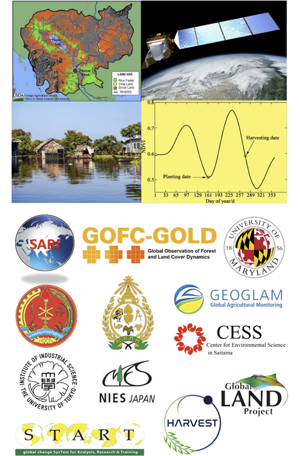
South/Southeast Asian countries are growing rapidly in population, industrialization, and urbanization. As a result, increasing land use/cover changes (LUCC) are evident in most countries. The most common LUCC changes include deforestation, logging, reforestation, agricultural expansion, urbanization, etc. Specific to South Asia, forest cover has increased in countries like India, Nepal, and Bhutan due to sustainable afforestation measures. In contrast, large-scale deforestation in Southeast Asian countries is continuing, for example, due to oil palm plantation expansion in Indonesia. Small-scale deforestation in most Southeast Asian countries is due to slash-and-burn agriculture by indigenous people, driven by poverty and population growth. Logging activities are common in Myanmar and Cambodia. Rapid urbanization is driving agricultural land loss. Agricultural intensification has been increasing due to less availability of land for growing food crops, for example, in India, Vietnam, and Thailand. The drivers of LU/CC vary widely in the region. They include land tenure, local economic development, government policies, inappropriate land management, land speculation, improved road networks, etc. LUCC can significantly affect food security through agricultural land loss. Also, the weather and climate systems in the region are driven primarily by monsoon variability, and extreme weather events resulting in droughts or flooding can impact agricultural production. In the region, monitoring the agricultural crop production on time is essential to predict and prepare for disruptions in the food supply. Despite the progress in remote sensing and geospatial technologies, little emphasis has been placed on national and regional operational systems useful for mapping and monitoring LULC, specifically forest and agriculture-related changes and impacts. Transitioning appropriate methods developed in the research domain into operational systems is a challenge for all countries but can provide improvements in timely and valuable information for forestry, agricultural management, and policy-making.
This workshop aims to review the availability, potential, and limitations of remote sensing data sources and methodologies useful for forestry and agricultural applications in South/Southeast Asia. The workshop presentations will focus on synergies among various approaches and provide recommendations on improving the role of earth observations, ground data, and modeling techniques to map and monitor forestry and agricultural changes in space and time. The workshop will bring together experts from both developed and developing countries to identify data gaps and needs related to operational mapping/monitoring of cropped areas in the South/Southeast Asia region. The following topics will be the focus of the science workshop:
- Land Cover/Land Use Changes and Impacts on the Environment
- LCLUC and Forestry (mapping, monitoring, and impacts)
- LCLUC and Agriculture (crop type mapping, monitoring crop yields, modeling, and impacts)
- Computational tools and Decision Support Systems for Forestry and Agriculture
The workshop will provide a forum to interact with South/Southeast Asia researchers involved in the SARI (South/Southeast Asia Research Initiative) and other international programs, including NASA LCLUC, SARI, GOFC-GOLD, GEOGLAM, GLP, NASA HARVEST, etc. Important needs and priorities for developing remote sensing-based approaches for mapping, monitoring, and LCLUC impacts in South/Southeast Asian countries will be identified involving forestry and agricultural experts from academic, government, and non-government organizations.
3-day Scientific Workshop
-August 8,9,10th, 2022
Scientific Field trip
-August 6,7th, 2022 (on own payment and invitation only)
Science Workshop Venue
Royal University of Agriculture, Auditorium hall, Dongkor District, Phnom Penh, Cambodia.
Mandatory Workshop Registration
All participants who intend to attend the meeting should register using the below link. Without registration, it will be difficult for us to provide logistic support (name badges, food, etc.). Only registered participants will be allowed to attend the meeting.
https://lclucmeeting.wufoo.com/forms/cambodia-meeting-royal-univ-of-agri...
2-day Research Information Exchange and Training
-August 11th and 12th, 2022
After the workshop, 2-day focused event will focus on sharing research information, data, algorithms by the international remote sensing experts. The Royal University of Agriculture, Auditorium hall, Dongkor District, Phnom Penh, Cambodia.
Mandatory Research Information Exchange and Training Registration
All participants who intend to attend should register using the below link. Without registration, it will be difficult for us to provide logistic support (seating, food, etc.). Only registered participants will be allowed to attend the meeting.
https://lclucmeeting.wufoo.com/forms/research-exchangetraining-11th12th-...
International Steering Committee
Dr. Krishna Prasad Vadrevu, Remote Sensing Scientist, NASA Marshall Space Flight Center, Huntsville, Alabama, USA, Phone: 256-321-9492; and Adjunct Associate Professor, Dept. of Geographical Sciences, University of Maryland College Park, USA; Email: krisvkp@umd.edu
Dr. Chris Justice, Professor, Department of Geographical Sciences, University of Maryland College Park (UMCP), NASA LCLUC Project Scientist, the GEOGLAM Program, 4321 Hartwick Road, Suite 400, College Park, Maryland, 20740, USA, Phone: 301.405.4050; Email: cjustice@umd.edu
Dr. Garik Gutman, NASA Land Cover/Land Use Change Program, Washington DC,USA
Dr. Toshimasa Ohara, Research director, Center for Environmental Science in Saitama (CESS), 914 Kamitanadare, Kazo, Saitama 347-0115, Japan.www.pref.saitama.lg.jp/b0508/cess-english/index.html
Dr. Tsuneo Matsunaga, Director, Satellite Observation Center, Head, Satellite Remote Sensing Section, Center for Global Environmental Research, National Institute for Environmental Studies, 16-2 Onogawa Tsukuba Ibaraki 305-8506 Japan; Email: matsunag@nies.go.jp
Professor, Wataru Takeuchi, Remote sensing of environment and disasters, Institute of Industrial Science, The University of Tokyo, Japan; Email:wataru@iis.u-tokyo.ac.jp.
Dr.Son Nghiem, Remote Sensing Scientist, Jet Propulsion Laboratory, USA; E-mail: Son.V.Nghiem@jpl.nasa.gov
Local Steering Committee
Assoc.Prof.Dr. Huon Thavrak, Vice Rector, Royal University of Agriculture, Dongkor District, Phnom Penh, Cambodia. Email:huonth@hotmail.com
Mr. KIM Soben, Dean of Faculty of Forestry, Royal University of Agriculture, Cambodia. Dongkor District, Phnom Penh, Cambodia. Email:kimsoben@gmail.com
Hor Sanara, Dean of Faculty Land Management and Land Administration, Royal University of Agriculture, Cambodia. Email:hsanara@rua.edu.kh
Mr. Thav Sopheak, Lecturer and Researcher, Faculty of Forestry, Royal University of Agriculture, Cambodia. Dongkor District, Phnom Penh, Cambodia. Email:sopheakthav@yahoo.com
Dr. Sakanann Vann, Researcher, Faculty of Forestry, Royal University of Agriculture, Cambodia. Dongkor District, Phnom Penh, Cambodia. Email:sakanannvann1992@gmail.com
Sok Serey, Royal University of Phenom Penh, Phenom Penh, Cambodia. Email: sokserey@gmail.com
Local Hotels
Hotel Cambodiana
https://hotelcambodiana.com.kh/
Himawari Hotel
http://himawarihotel.com/
Raffles Hotel Le Royal (5stars)
https://raffles.com/phnom-penh/
Sofitel Phnom Penh Phokeethra
https://sofitel-phnompenh-phokeethra.com/
Sokha Phnom Penh Hotel
https://sokhahotels.com/residence/
Le President Hotel
www.lepresidenthotel.com/index.html
Meeting Presentations
DAY 1 (8TH AUGUST, MONDAY)
Opening Session-I
Welcome Address – Huon Thavrak (Vice Rector, Royal University of Agriculture, Cambodia) 9:15
Welcome Remarks –Garik Gutman (NASA HQ, USA)
Welcome Remarks - Krishna Vadrevu (NASA Marshall Space Flight Center, USA)
Welcome Remarks –Matsunaga Tsuneo (National Institute of Environmental Studies, Japan)
Session-II: Programmatic Presentations
Chair: Garik Gutman (NASA LCLUC Program, USA)
NASA LCLUC Program Updates – Garik Gutman (NASA Headquarters, USA) Garik Gutman_D1_Seesion II.pdf
NASA South/Southeast Asia Research Initiative (SARI) Updates – Krishna Vadrevu (NASA MSFC, USA) Krishna_Vadrevu_D1_Session II.pdf
USAID's Environment Program in Cambodia – Andrea Pavlick (USAID, Cambodia)Andrea_Pavlick_D1_Session II.pdf
Session-III: LCLUC and Forestry
Chair: Mark Cochrane (University of Maryland Center for Environmental Sceince (UMCES), USA)
Co-Chair Thav Sopheak (Royal University fo Agriculture, Cambodia)
Transformative Change of Land Cover and Land Use in Southeast Asia - Son Nghiem (JPL, California Institute of Technology, USA)Son_Nghiem_D1_Session III.pdf
Geospatial Data Needs and Priorities in Cambodia – Thy Try (Open Development Cambodia (ODC), Cambodia)Thy_Try_D1_Session III.pdf
The Impact of Land Use and Land Cover Change on River Morphology - Kasturi Kanniah (Universiti Teknologi Malaysia)Kasturi_Kanniah_D1_Session III.pdf
Spatial and Temporal Analysis of Land Use Land Cover of Preah Sihanouk Province, Cambodia Seng Bunthion, Ministry of Environment, CambodiaSeng Bunthoeun_D1_Session III.pdf
Land Use and Ecosystem Services in Traditional Home Gardens in Sri Lanka - Ajith Gunawardane (Central Environmental Authority, Sri Lanka)Ajith_Gunawardane D1_Session III.pdf
Dynamic Landslide Hazard Evaluation using Persistent Scatter Interferometry for Environmental Impact Assessment - Luis Carlos Mabaquiao (Univ. of Philippines, Diliman) Luis_Carlos_D1_Session III.pdf
Session-IV. LCLUC and Forestry
Chair: Tsuneo Matsunaga (National Institute of Environemtal Studies (NIES), Japan)
Oil Palm and Land Cover Change Dynamics in Indonesian Peatlands – Mark Cochrane (University of Maryland Center for Environmental Science (UMCES), USA)Mark_Cochrane_D1_Session IV.pdf
Open data for Forest Cover, Land Cover and Land use – Koem Chhuonvuoch (Open Development Cambodia (ODC), Cambodia)Koem_D1 Session IV.pdf
Mangrove Phenology And Environmental Drivers Derived from Remote Sensing In Southern Thailand - Werapong Koedsin (Prince of Songkla University Phuket Campus, Thailand) Werapong_Koedsin_D1_Session IV.pdf
Analysis of Borneo Terrestrial Ecosystem Change Using Satellite Solar-Induced Fluorescence (SIF) Data - Kazutaka Murakami (NIES, Japan) Kazutaka_Murakami_D1_Session_IV.mp4
An Overview of GEDI Lidar Satellite for Forestry Resource Monitoring - Opportunities and Challenges in SE Asia - Hao Tang (National University of Singapore) Hao_Tang_D1_Session IV.pdf
DAY 2 (9TH AUGUST, TUESDAY)
Session-I. Agricultural LCLUC
Chair: Krishna Vadrevu (NASA MSFC, USA)
Co-Chair Phy Chhin ( Directorate of Agriculture, Cambodia)
Rethinking Agrarian Transition Through Rice Farming in Southeast Asia - Jeff Fox (East West Center, USA)Jeff_Fox_D2_Session I.pdf
Land Cover/Land Use and Agriculture in Cambodia - Current Status and Priorities – Seng Vang (General Directorate of Agriculture, Cambodia) Seng_D2_Session I.pdf
Crop Mapping and Monitoring in Thailand and CLM (Cambodia, Laos and Myanmar) Countries – Panu Nuangjumnong (GISTDA, Thailand) Panu_D2_Session I.pdf
Drought and Crop Yield Modeling Impacted by Climate Change in the Mekong River Basin – Venkataramana Sridhar (Virginia Tech, USA)
Climate Change Impact on Rice Yield and Food Security in the Riverine Communities In Cambodia – Sok Serey (Royal University of Phnom Penh, Cambodia)Sok_Serey_D2_Session I.pdf
Suitability Analyses of Paddy Fields and Coffee Plantations in Indonesia Under Climate Change Scenarios - Edvin Aldrian (BMKG, Indonesia)Aldrian _D2_Session I.pdf
Impact of Agricultural Land Expansion on Land Use Change and Land Degradation in Cambodia Phanith Chou and Taingaun Sourn (Royal University of Phnom Penh, Cambodia)Phanit and Taingaun_D2_Session I.pdf
Land Use Shifts in Indian Agriculture - Nilabja Ghosh (Delhi University, India) Nilabja Ghosh D2_Session Ii.pdf
Session-II. Agriculture – Crop mapping, monitoring, acreage estimation and modeling
Chair: Seng Vang (Directorate of Agriculture, Cambodia)
Co-Chair: Sridhar Venkataramana (Virginia Tech, USA)
Asia Rice and JAXA Activities – Shinichi Sobue (JAXA, Japan) Shinichi_D2_Session ii.pdf
Applying RIICE Technology for Rice Crop Monitoring and Insurance in Cambodia -Phy Chhin (General Directorate of Agriculture, MAFF, Cambodia)Phy_D2_SessionII.pdf
Rice Crop Mapping and Yield Estimation in the Mekong Delta and Red River Delta, Vietnam – Lam Dao Nguyen (VNSC, STAC, Vietnam) Lam Dao Nguyen_D2_Session II.pdf
Pixel-Based Evaluation of Rice Production and Related Greenhouse Gas Emissions In The Mekong Delta Via a Digital-Twin System With a Simultaneous Data Assimilation Scheme of SAR Data And Ground Observations - Hironori Arai (CESBIO, France)Hironori_D2 _Session II.pdf
Groundnut Acreage Estimation and Yield Modeling in Part of West and South India using Satellite Images - Dharmesh Verma (India)
Decision Support Tools for Food Security – Yasar Khan (World Resources Institute, India)Yasar_D2_Session II.pdf
Soil Texture Classification Using Lab Spectroscopy Techniques - Chirag Ternikar (Indian Institute of Science, India)Chirag_D2_Session II.pdf
DAY 3 (10TH AUGUST, WEDNESDAY)
Session-I. Emission inventories, GHG’s and Aerosols
Chair: Tsuneo Matsunaga (NIES, Japan)
Co-Chair: - Siwatt Pongpiachin (NIDA, Thailand)
GOSAT-2 Observation in Southeastern Asia Over the Past Three Years: CO2, CH4, CO, And Aerosol - Tsuneo Matsunaga (National Institute of Environmental Studies, Japan) Matsunaga_D3_Session I.pdf
Vegetation Fires in South/Southeast Asia and Emissions during COVID-2020 and Pre-Pandemic- Krishna Vadrevu (NASA MSFC, USA)Krishna_D3_ Session I.pdf
Role of Land and Forest Fire Management on Indonesia's Forest and Other Land Use (FOLU) Net Sink 2030 - Israr Albar (Directorate of Land and Forest Fire Management, Ministry of Environment and Forestry, Indonesia) Israr_D3_Session I.pdf
Forestry and Carbon Emission from Cambodia – Thav Sopheak (Royal University of Cambodia) Sopheak_D3_Session I.pdf
Greenhouse Gases Fluxes Across Land-Use Gradient in Sabah, Malaysia - Justin Sentian (Univ. of Malaysia Sabah, Malaysia)Justin D3 Sessionn I.pdf
Multi-sensor Satellite Data for Estimating PM2.5 across Malaysia - Kasturi Kanniah (University of Technology, Malaysia)Kanniah D3 Session I.pdf
Solar PV Mapping With Remotely Sensed Data, and Prospects for the less GHG Emission Society Based on the Efficient Strategy of Solar Power Production - Shoki Shimada and Wataru Takeuchi (University of Tokyo, Japan) Shoki D3 _Session I.pdf
Session-II. Emission Inventories of Air Pollutants, SLCP, GHG’s and Aerosols
Chair: Kasturi Kanniach (Universiti Teknologi Malaysia)
Co-Chair: Israr
Alabar (Ministry of Environment and Forestry, Indonesia)
Vegetation fires in Indonesia and Meteorological Drivers – Edvin Aldrian (BKMG, Indonesia) Aldrian_Edvin_D3_Session II.pdf
Impact of Biomass Burning on Aerosol Properties in Penang, Malaysia - Hwee SanLim (University Sains, Malaysia) Hwee_SanLim_D3_Session_II.mp4
Validation of GOSAT-2/CAI-2 Aerosol Products (Optical Properties) in Southeast Asia – Akihiro Uchiyama (NIES, Japan)Uchiyama_D3_Session II.pdf
Influence of Open Biomass Burning on Fine and Ultrafine Airborne Particles in Phnom Penh, Cambodia - Worradorn Phairuang (Kanazawa University, Japan)
Emission Factors From Combustions of Biomass Materials for Source Apportionment—A New Database For 17 Plant Species - Siwatt Pongpiachin (NIDA Center for Research and Development of Disaster Prevention and Management, Thailand) Siwatt_D3_Session II.pdf
Discussion Session – Research Needs and Priorities
Chair: Garik Gutman (NASA HQ, USA)
Co-Chair: Krishna Vadrevu (NASA MSFC, USA)
Meeting Outputs – Krishna Vadrevu (NASA Marshall Space Flight Center, USA)
Vote Of Thanks – Thav Sopheak, Garik Gutman, Matsunaga Tsuneo and Krishna Vadrevu