Team Members:
| Person Name | Person role on project | Affiliation |
|---|---|---|
| Stephen Leisz | Principal Investigator | Colorado State University, Fort Collins, US |
| Arthur Rambo | Collaborator | |
| The An Ngo | Co-Investigator | |
| Andreas Heinimann | Co-Investigator | University of Bern, Vientiane, Switzerland |
| Eric Rounds | Graduate Student Researcher | Colorado State University, Fort Collins, USA |
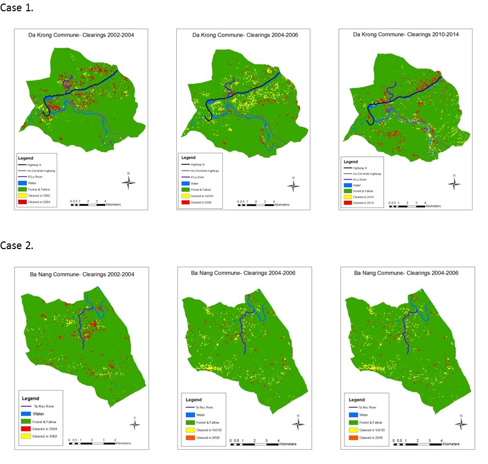
The proposed project will investigate the impact that the East-West Economic Corridor from Da Nang, Vietnam, to Khon Kaen, Thailand, is having on land-use and land-cover, and urban growth patterns in three different, yet contiguous, countries with different political histories and current policies. In order to do this the project will work at the intersection of physical and social science and make use of a cross-section of remotely sensed data and social science data. Remote sensing data for three time periods will be collected. In order to create a baseline of land-cover for the EWEC and to understand the land-use associated with this baseline land-cover, Landsat and SPOT data from 1982 through 1990 (the first time period) and 1990 to 2000 (the second time period) will be collected and analyzed. For the third time period, from 2000 to 2011, 16 day 250 m MODIS VI products over yearly time steps will be acquired and hypertemporal analysis of the EWEC corridor will be done. This analysis will use hypertemporal characteristics as identifiers of where change is taking. Post-2000 Landsat and SPOT data will be used to investigate identified trends on a year-to-year basis. High resolution data (air photos and high resolution satellite imagery) will be used for ground truthing of hard to get to areas. Field-work will be done to ground truth satellite imagery collected. Recall data will be used to validate the baseline land-cover and land-use classifications done for the first two time periods. Time series population census data and agricultural census data forthe EWEC area that correspond to the remote sensing data will be obtained. This data will be integrated with other available data (economic data, data regarding country specific and regional policies, institutional data, cultural data, livelihood systems data, etc.) within a geographic information system (GIS). As part of the ground-truthing, interviews will be carried out in the EWEC in each country to investigate the role that the EWEC is playing in the population s livelihood systems and movements within the corridor. Data available from censuses and surveys will be used to score communities on characteristics such as population of smallholder cultivators, increase in non-agricultural activities, population mobility, mixture of land-uses, and female labor participation. The LCLUC, rural, urban, and peri-urban nature of the EWEC within each of the countries will be investigated by analyzing in tandem the remote sensing and social science data collected. The census and LCLUC data will be integrated to develop an index of urbanicity of the transportation corridor and to understand how the urbanicity of the corridor has changed from the baseline period to the present day and what roles the differing government policies have on these changes and on land cover/land use changes. Connections between LCLUC rural-urban transitions and urban growth will be investigated using GIS and spatial statistics tools and agent-based modeling.

 Principal Investigator
 Postdoc Researcher