Team Members:
| Person Name | Person role on project | Affiliation |
|---|---|---|
| Mark Friedl | Principal Investigator | Boston University, Boston, USA |
| Lucy Hutyra | Collaborator | Boston University, Boston, United States |
| Curtis Woodcock | Collaborator | Boston University, Boston, USA |
| Steve Wofsy | Collaborator | |
| Kelly Chance | Collaborator |
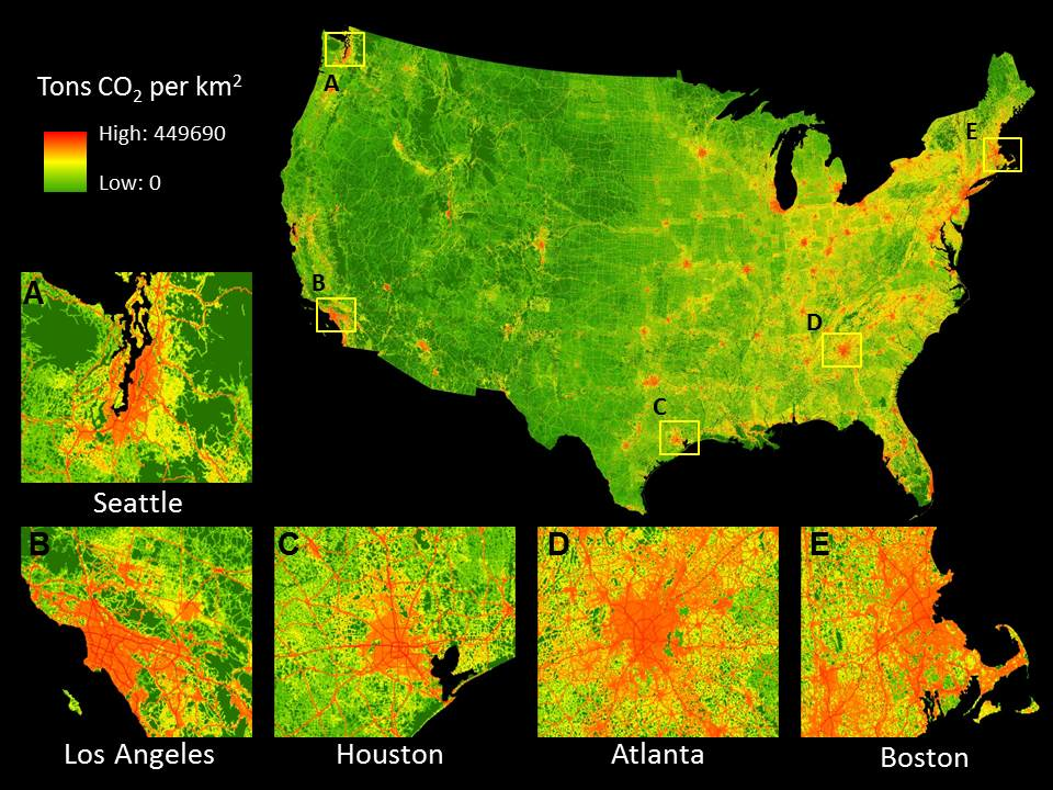
Urban areas represent a critical gap in current measurement networks and modeling frameworks that must be addressed to improve understanding of human impacts on the global environment, for climate prediction, and for treaty verification. Nearly threequarters of anthropogenic greenhouse gas (GHG) emissions are attributable to cities, but most efforts to study atmospheric and terrestrial carbon dynamics avoid urbanized areas. Measurement networks, analytical techniques, and basic understanding of carbon cycle processes in and around urban areas are currently not able to characterize urban carbon sources and sinks or to define the influence of urban ecosystems and the urban complex on regional atmospheric composition. The research described in this proposal addresses sub-element 2 of solicitation NNH11ZDA001N-IDS in NASA ROSES 2011 (Interdisciplinary Research in Earth Sciences ), which requests proposals that address the impacts of urbanization on the environment. Specifically, we propose to develop and implement an interdisciplinary measurement and modeling framework that combines explicit treatment of urban emission sources, urban ecology, atmospheric transport of GHGs, and land cover change dynamics in a comprehensive treatment of carbon flows in and around densely populated regions. Using southern New England and the New York to Boston corridor as our domain, we will integrate remote sensing data, surface GHG observations, atmospheric transport models, and high resolution models of biogenic and anthropogenic sources and sinks to characterize GHG emissions and quantitatively link emissions to source processes and socioeconomic drivers over our study domain. As part of our analysis we will explore the role of historical land cover change on regional carbon budgets, and develop remote sensing and in-situ data sets in support of model development and validation. The proposed research will include three main elements: (1) modeling and analysis of past land use and land cover change impacts on regional carbon budgets using the Landsat archive in association with a terrestrial carbon model (2) analysis and modeling of contemporary carbon budgets using a combination of surface measurements and high vertical, horizontal, and temporal resolution column estimates for GHGs using an invertible atmospheric transport model and (3) field and remote sensing observations of carbon stocks and fluxes derived from ground measurements and satellite-based remote sensing assets. The results from this project will provide a novel framework for characterizing and modeling carbon and GHG dynamics in and around urban areas, and will advance our ability to understand and model the effects of urban and suburban land use and land cover changes on regional carbon budgets. Our model framework directly connects drivers of emissions (transportation, home heating, electricity generation) to emissions and atmospheric concentrations in the urban dome and downwind. The models and observations developed in this work will be transferable to other urban areas and will provide a powerful new tool for validating measurements of the urban CO2 column derived from NASA s Orbiting Carbon Observatory (OCO-2), for using OCO-2 data for scientific studies and policy analysis in the urban domain, and for verification of greenhouse gas agreements and treaties

 Principal Investigator
 Postdoc Researcher