Landsat 9 Mission
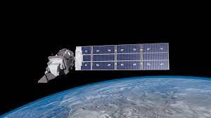
Landsat 9 is the latest Earth observation satellite in the Landsat series and it was launched on 27 September 2021. Landsat 9 will continue Landsat's irreplaceable record of Earth's land surface. Since 1972, Landsat data have provided a unique resource for those who work in agriculture, geology, forestry, regional planning, education, mapping, and global-change research. Landsat images have also proved invaluable to the International Charter: Space and Major Disasters, supporting emergency response and disaster relief to save lives. With the addition of Landsat 9, the Landsat program’s record of land imaging will be extended to over half a century.
Landsat 9 is a partnership between the National Aeronautics and Space Administration (NASA) and the U.S. Geological Survey (USGS) and will continue the Landsat program’s critical role of repeat global observations for monitoring, understanding, and managing Earth’s natural resources.
Masek, J., M.A. Wulder, B.L. Markham, J. McCorkel, C.J. Crawford, J. Storey, and D.T. Jenstrom. (2020). Landsat 9: empowering open science and applications through continuity. Remote Sensing of Environment 248. doi:10.1016/j.rse.2020.111968
For more Information please visit: usgs.gov